The western US is in dire need of rain, but lightning strikes could create more fires
After enduring heat waves and years of minimal monsoonal moisture, the desert Southwest is seemingly back on track with an already above-average monsoon season.
The region expects to see temperatures below average all week due to the rainfall, bringing a welcome relief after extreme heat early in the summer.
Cooler temperatures and widespread rainfall could help satiate the parched soil, and the WPC expects improvements to the drought as a result.
Southwest monsoon rains continue
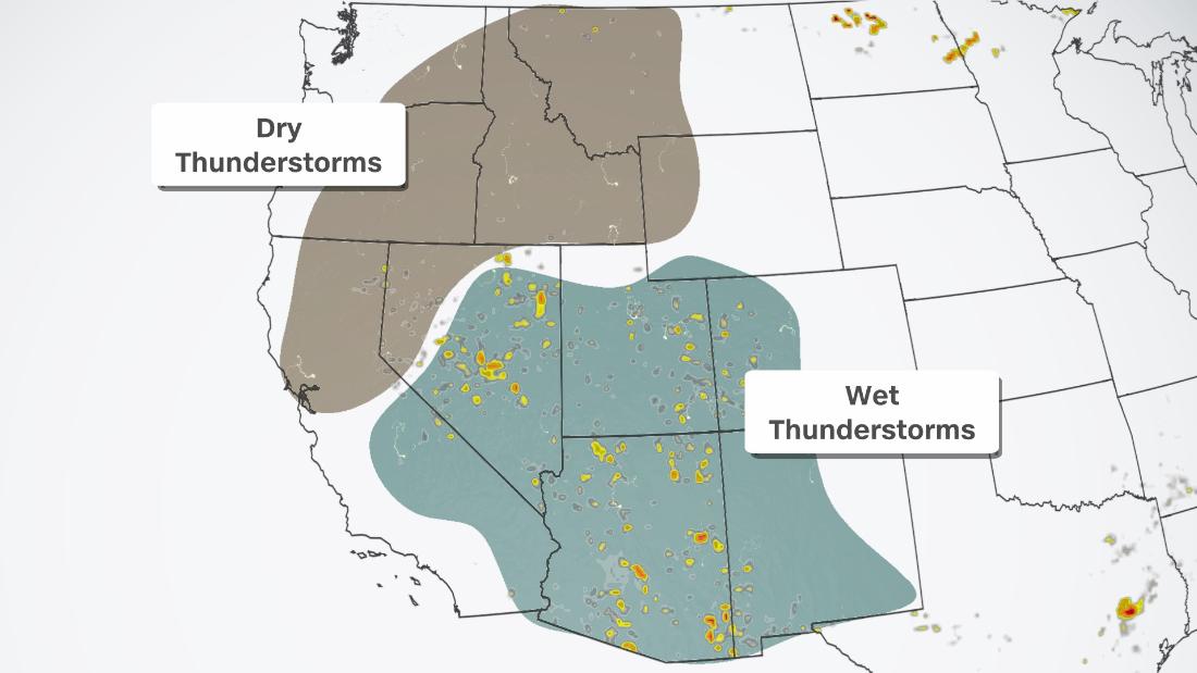
Monsoon thunderstorms this week are expected to continue to bring life-giving rains to the region. Monday and Tuesday rain showers and strong thunderstorms will range from Arizona through the Great Basin.
“Isolated to scattered thunderstorms will again develop over the higher terrain around noon before drifting into the valleys later in the afternoon through the evening,” said the National Weather Service (NWS) in Las Vegas.
The main threats associated with the strongest storms will be heavy downpours causing flash flooding and strong wind gusts of up to 50 miles per hour that could produce blowing dust.
As the week progresses, the monsoonal moisture will be centralized over the Four Corners, spreading slightly northward into parts of Wyoming at the end of the week.
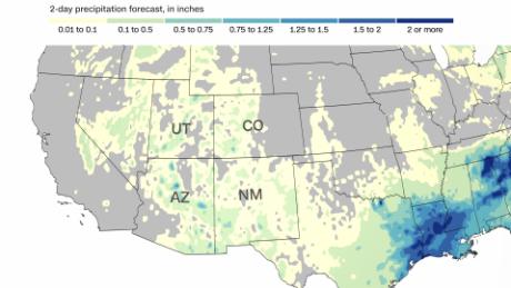
Thursday and Friday see rain totals ramping up, with up to an inch and a half of rainfall per day in some areas. Heavy rain becomes more widespread into Thursday and Friday, when Utah, western Colorado, and western New Mexico will experience slightly higher rain totals than at the beginning of the week.
Flash flood watches have been issued across four states in the Southwest, including California, Nevada, Utah and Arizona, in effect through Monday afternoon and evening due to the potential for flash flooding in areas that see localized heavy rainfall.
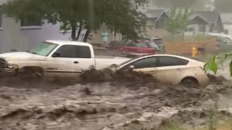
Last week, flash flooding became a major issue in Arizona and Utah, leading to scenes of cars sweeping down neighborhood roads on feet of rushing water and train derailments resulting in injury.
Burn scars from wildfires in the region are the greatest areas of concern for flash flooding — after a fire incinerates a swath of land, the ground left behind is hydrophobic, acting more like concrete than a sponge. Rainwater then easily flows off the burnt soil, sometimes drastically, causing flash flooding events.
The rain brought by monsoon season is a sigh of relief, but lightning from the stronger thunderstorms could cause more harm than good, producing more fires and leaving behind more burn scars.
More lightning could mean more wildfires
Four large fires are currently burning in Arizona, and the dry vegetation from the drought could cause concern with any lightning produced from monsoon thunderstorms. Luckily, most of the storms will contain plenty of rainfall and moisture, the biggest threat being flash flooding.
This monsoon season has been more active than the seasons in 2019 and 2020, but the NWS in Phoenix points out that there have been a below-average number of lightning strikes compared to the average since 1990 — a good thing for the extremely active fire season.
A different story could play out this week in the Great Basin and Northwest, where dry thunderstorms are expected to cause wildfire concerns Monday and Tuesday.
Northern California and southern Oregon will see elevated fire weather conditions on Monday due to the potential for dry thunderstorms in an area that is already devastated by the country’s largest wildfire.
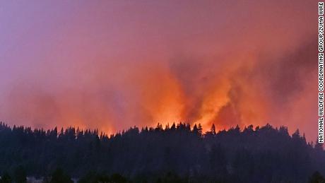
The Bootleg Fire, located near the border of California and Oregon, has seared more than 300,000 acres of forest. Fire officials have said that it might take a significant weather event to put it out.
“We are experiencing extremely dry conditions with record to near-record temperatures. Conditions on the ground due in part to the historic drought have accelerated the fire season. The combination of the weather and fuel conditions have led to the rapid growth of the fire,” Fire spokesperson Katy O’Hara told CNN.
“The scope and scale of the Bootleg Fire will require a season-ending weather event such as a significant storm that is either widespread wetting rain or snow, which in southern Oregon typically occurs in the late fall,” O’Hara said.
This week, conditions are not looking favorable to help with firefighting efforts, and lightning initiations from dry thunderstorms could make matters worse.
“Isolated dry thunderstorms may also form in northern Idaho and western Montana with very hot, dry, and unstable conditions across the inland Pacific Northwest, Northern Rockies and Plains into northern Minnesota, and northern Great Basin,” said the NIFC.
The SPC has highlighted critical fire danger in eastern Montana as winds pick up during a record heat event. Montana currently has 14 large wildfires burning, the most in the country just above Idaho with 13.
“During the afternoon, 20 mph sustained southeasterly surface winds will likely overlap with 15-20% relative humidity for at least a few hours. While the winds are somewhat marginal for Critical highlights, a Critical area has been maintained for portions of eastern Montana into far northeast Wyoming given the presence of Critically/record dry fuels,” the SPC said.
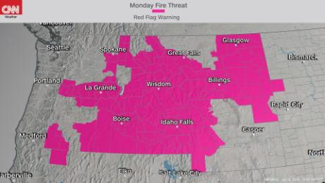
Over 3 million people are included in red flag warnings across the Northwest and Northern Great Plains on Monday as fire danger runs high. Nearly the entire states of Idaho and Montana are in red flag warnings, and excessive heat warnings encompass all of eastern Montana where temperatures are climbing into the triple digits once again to start the week.
![]()


