Massive heat dome brings yet another heat wave, this time covering most of the US
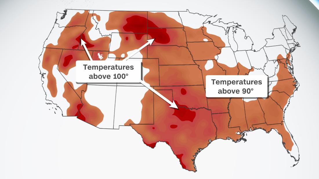
Although not as extreme as the past few heat spells, this one will span from coast to coast due to a strong heat dome elevating temperatures even higher during the hottest time of the year. The epicenter of the heat will build across the northern and central Plains — a region that has largely escaped the relentless, record-breaking heat the past few months.
A broad ridge of high pressure will expand over much of the country by the beginning of next week bringing with it potentially record high temperatures to the Plains. Most states that have been sitting below average through the summer will begin to see temperatures near average or slightly above in the Southeast and Southern Plains.
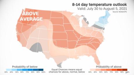
Above-average temperatures range from the Pacific Northwest east to the Tennessee River Valley as the heat dome dominates the weather pattern.
Heat warnings and advisories are already in effect for some areas of the Midwest, where heat index values on Saturday will begin to climb into the triple digits. More advisories are likely to be issued for the week ahead as the heat builds.
New Orleans, Kansas City and St. Louis are included in heat advisories affecting more than 13 million people at the start of the weekend. Above-average temperatures will begin to spread across the nation on Friday, but will become widespread by next week.
Heat expands this weekend
Daily high temperature records could fall in areas across Montana that have already seen records crushed earlier in the season.
Friday and Saturday will be a slight lull in the state’s most recent heat wave before temperatures soar once again into the triple digits by the end of the weekend. Highs will near records once again and low temperatures will provide little reprieve.
By end of this weekend, the ridge will expand into the northern Plains after a brief lull in the already torrid temperatures some areas have felt all summer.
Widespread triple digits will hit the western and central US on Monday, with highs in the 100s spanning the Great Basin, northern Plains and southern Plains.
The heat dome could bring an excessive heat event to Montana, Nebraska, North Dakota, South Dakota and Wyoming at the beginning of next week with temperatures 10 to 20 degrees above average.
It’s not a dry heat
High humidity values will amp up the heat even more, leading to “feels like temperatures” of more than 100 degrees across the central US throughout the week. Moisture surging north from the Gulf of Mexico will allow for these heat indices to climb into the triple digits in places like Dallas and Oklahoma City.
Southeastern Montana, northeastern Wyoming, North Dakota and South Dakota will see the hottest day on Monday when temperatures reach the century mark in most places. Parts of northern Nevada and southern Idaho also see high temperatures peak Monday.
On Tuesday the highest temperatures begin to shift southeastward as a front approaches from the northeast moving south toward the Dakotas.
By midweek temperatures in the triple digits will span from South Dakota to southern Kansas, pressed southward by the frontal boundary to the North. Texas and Oklahoma will see temperatures nearing triple digits throughout the week due to the ridge of high pressure as well.
Summer heat arrives across the Southeast
The area expected to experience the most extreme temperatures is located in the north-central Plains, but across the southern US high temperatures will be widely above 90 degrees for the first time this month.
“After only having seven days of 90 degree or higher temperatures all year so far, we are looking at eight in a row … at least,” said CNN meteorologist Brandon Miller about the heat coming to Atlanta, Georgia.
From the southern Plains to the Mid-Atlantic, seasonal or above-average temperatures are forecast for the coming week. Highs in the 90s spanning from Amarillo to Philadelphia will give the region its first widespread taste of hot summer temperatures this year.
Along with the cooler conditions, rain persisted throughout June, bringing much of the Gulf Coast region above-average precipitation totals.
Extensive rain events and the heat waves centered over the Pacific Northwest allowed the region to remain cooler and wetter than the rest of the country, a pattern that is coming to an end with the arriving heat.
![]()


