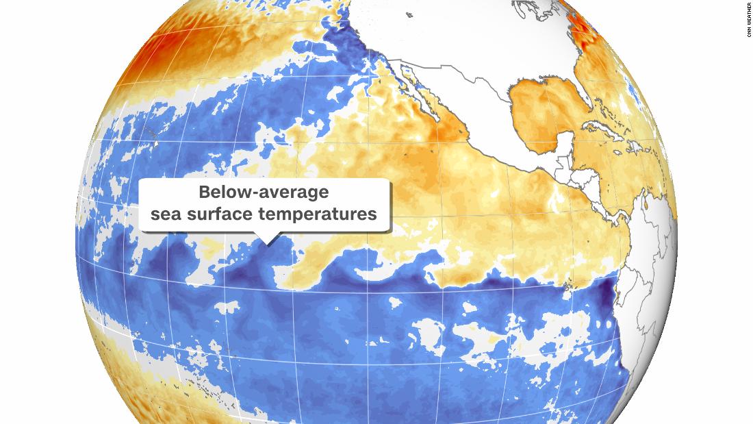
The cooling of sea surface temperatures in the Pacific will affect winter weather, drought conditions and the remainder of hurricane season
La Niña typically brings conditions that are wetter and cooler than average to the Pacific Northwest and northern Plains, especially during the winter.
In contrast, La Niña means drier and warmer-than-average conditions usually prevail in the South. This could mean the drought-stricken Southwest will likely stay drier. (La Niña also was present last winter and worsened the drought situation across the West and Southwest.)
The Southeast is also typically drier during a La Niña winter, though before the season starts, it increases the possibility for tropical weather, including hurricanes.
La Niña will persist through winter in the US
“La Niña is anticipated to affect temperature and precipitation across the United States during the upcoming months,” the center said as it issued a La Niña advisory Thursday, predicting conditions are present and expected to remain.
The advisory replaces the La Niña Watch, which indicated favorable conditions for development that had been in place since July.
Both La Niña and El Niño occur every three to five years on average, according to NOAA.
La Niña’s impact on the rest of hurricane season
During La Niña, weaker winds between the ocean surface and upper levels of the atmosphere impact global jet streams and can influence the track and severity of winter storms and hurricanes during warmer months.
“La Nina is associated with reductions in vertical wind shear in the Caribbean and tropical Atlantic,” said Phil Klotzbach, a research scientist at Colorado State University. “Too much shear is typically what ends the Atlantic hurricane season, so La Niña can extend the active part of the season.
“Last year is a great example of this, as we had six hurricanes and five major hurricanes in October-November,” he said. “While we certainly don’t expect to see that much activity the remainder of this season, the development of La Niña does leave the window open for more late-season storm activity this year.”
La Niña and the climate crisis
While El Niño and La Niña events are regular aspects of global weather patterns, increased global temperatures may temper or change their effects.
La Niña tends to pull down global temperatures, but in recent years, the planet has warmed so fast, it’s like hitting a small speed bump at 80 mph — it barely even registers.
Top spots on the warmest-years list used to be reserved for the strong El Niño years, but human influences have long since overwhelmed the planet’s natural temperature regulators. For instance, La Niña was present during parts of 2020, but the year still tied with 2016 (an El Niño year) as the hottest on record for the planet.
![]()


